


Several places around Sussex were flooded over the weekend, as the Met Office releases a yellow warning for rain from 5am until 12pm tomorrow (November 14).
A band of squally, thundery rain is likely to push quickly east across the warning area through Tuesday morning, sweeping over East and West Sussex and Brighton & Hove.
The Met Office says sudden, torrential downpours will bring 15-20 mm of rain in a short period of time. Showers will likely be accompanied by thunder and lightning.
Gusts of winds to 40-50 mph are also likely, as is hail. The last of the showers should clear into the North Sea late Tuesday morning.
What to expect
- Probably some damage to a few buildings and structures from lightning strikes or strong and gusty winds
- There is a good chance driving conditions will be affected by spray, standing water and/or hail, leading to longer journey times by car and bus
- Delays to train services and journeys by plane are possible
- Some short term loss of power and other services is likely
Flansham Solar Farm


A29, Shripney
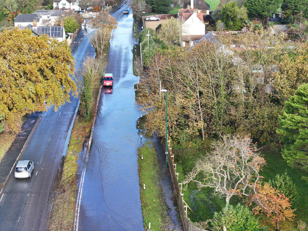

Bognor Bypass

 Hastings Museum & Art Gallery And Groundwork South Launch Project For Ore Residents
 Company Director Prosecuted For Breaching Fire Safety Regulations
 Iconic Ashdown Forest To Host Special Walk For National 'Dogs In Yellow Day'
 Multi-Million-Pound Scheme To Boost West Sussex Water Quality Complete
 County Council Supports NHS England Breast Screening Campaign To Help Detect Cancers Earlier
 Chichester District Council Give Approval For 30 New Homes In Earnley
 Brighton Seafront Champion Spells Out Concerns About Board
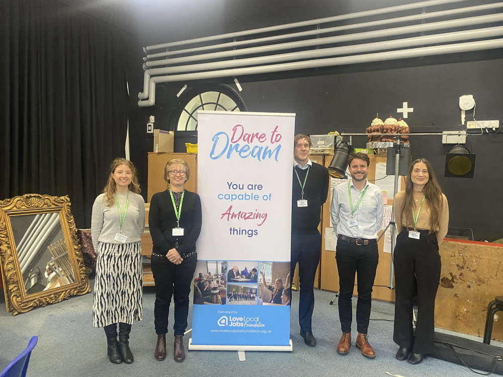 Sussex Law Firm Partners With Dare To Dream To Inspire Young People
 Life Sentence For Man Who Drugged And Raped Women And Girls
 Eastbourne Council Helps Students Build Bright Careers
Comments
Add a comment