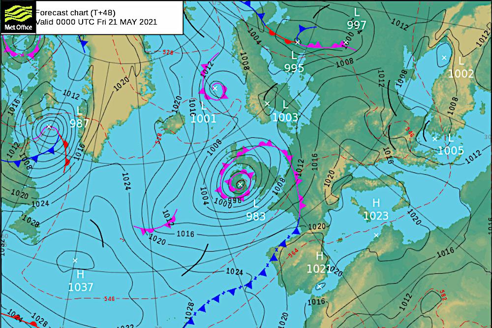
Britain's official weather forecasters have predicted travel disruption in Sussex on Thursday night (May 20) and into Friday morning.
Met Office staff added temporary outdoor structures, such as garden furniture and gazebos, could be blown away.
There could also be a danger to some tree branches.
But they said the worst winds would be along the Sussex coast and in hilly areas, as inland gusts of up to 50 mph become worse at the water's edge and on the South Downs.
There, wind speeds of up to 60 mph could be felt.
A Met Office spokesperson described the weather system:
"An unusually deep area of low pressure for the time of year will move slowly eastwards across a central swathe of the UK during Thursday night and Friday.
"In addition to some heavy rain, this low will bring with it a spell of relatively high winds.
"The windiest conditions will start to affect south Wales and southwest England Thursday late afternoon and evening before spreading across southern England Thursday night and early Friday.
"Inland, gusts up to 45 to 50 mph are expected at times whilst over coasts and hills gusts will reach as much as 55 to 60 mph.
"These high winds then slowly ease from the west later on Friday."
Below is an animation of the storm crossing the UK, using data supplied by the German Deutsche Wetterdienst service.
Darker colours mean stronger winds, and Sussex has the strongest in England at one point.

 Funding Available For Tree Planting In Chichester District as National Tree Week Begins
 West Sussex Firefighters And Emergency Services Carry Out Training Exercise In Chichester Harbour
 Shoreham Lifeboat’s Festive Look Boosted By Family-Run Business
 Final Touches Being Made To £2m Sussex Wastewater Site Upgrade
 AllSaints Founder To Host Sustainable Fashion Show In Brighton To Raise Money For Homelessness In City
 Chichester Community Warden Helping Fight Against Fraud This Christmas
 Wealden Council Calls For Government Rethink On Winter Fuel Payment
 Snowy Protest At Lewes County Hall Calls For Fossil Fuel Divestment
 Local MP Tours Firefighters’ Centre In Littlehampton
 Former Portslade Scout Leader Convicted Of 79 Child Sex Offences