Snow is expected to hit parts of the UK in the coming days as temperatures take a tumble towards freezing.
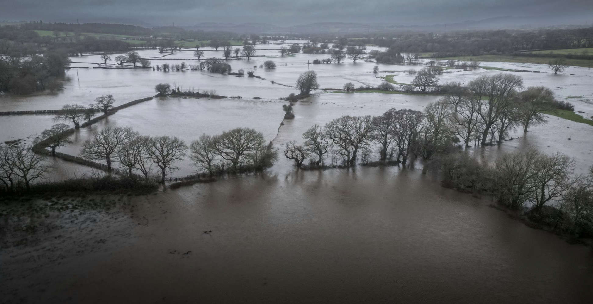
Scores of flood warnings and alerts also remain in place following heavy rain that has left roads and fields underwater and threatened homes.
Further downpours are forecast over the weekend and it will remain windy as well as turning colder.
Showers will increasingly fall as snow, especially across northern areas.
Sky News weather presenter Jo Edwards said:
"This current run of very lively weather is still being driven by an active jet stream and the next few days will see low pressure systems queuing up in the Atlantic to bring further rain and strong winds.
"However, temperatures trend downwards over the weekend with a greater risk of seeing wintry hazards such as snow and ice.
"Saturday will bring another deluge accompanied by strong winds. This time it'll be the south coast that bears the brunt of the windy weather.
"Sunday's showers are likely to be wintry in the north, even to lower levels.
"Looking ahead to Monday and Tuesday - spells of rain in the south are likely to be preceded by hill snow in higher areas."
On Friday morning, there were 90 flood warnings and 166 alerts in force across England, stretching from Devon up to Newcastle and Cumbria.
There were eight flood warnings in Scotland and seven in Wales.
In York, levels on the River Ouse were about 3.8m above normal and predicted to rise further overnight.
Shrewsbury in Shropshire was another of the areas affected, with the council saying flooding was disrupting traffic in the town centre.
Shaun Jenks said on Twitter that there was "gridlock" in the town and that it was "now at the mercy of the River Severn" as flood defences were being put up.
Fire crews in Keynsham in Somerset had to rescue people from submerged vehicles on Old Bristol Road on Thursday.
And on Friday, the local football side posted images of their pitches looking like swimming pools and joked about needing a water polo team instead.
The Environment Agency's Mark Garratt advised people to check their flood risk, stay away from swollen rivers and not drive through floodwater.
Mr Garratt said:
"The Environment Agency is monitoring flood levels, operating flood gates and barriers at locations across the country, and ensuring debris screens are clear from blockages to ensure communities are better protected."
Andy Wall, from Natural Resources Wales, said there was "widespread travel disruption with flooding of low-lying land and roads".
He added:
"Given the rainfall being forecast by the Met Office into the weekend, we would expect to see rivers full again, and are quite likely to see flooding onto floodplains, farmland, minor roads, and we could see some property flooding, particularly in isolated communities in low-lying areas."
Rod Dennis, from RAC Breakdown, said driving in floodwater "is never worth the risk" as it can endanger passengers and potentially "cause catastrophic damage" to vehicles.
"We encourage all drivers to turn around and find another route if they encounter deep standing water," he said.

(c) Sky News 2023: UK weather: Snow forecast as flooding hits swathes of the UK with more rain on the way


 Man Admits To Damaging Cars In Bognor
 Two Men Arrested In Connection With Brighton Rape
 Appeal Following Assault In Horsham Shop
 Appeal After Arson At Gym In Burgess Hill
 Two Men Sought In Connection With Brighton Rape
 Councillors Support Baby Box Partnership With Charities
 Brighton And Hove Bus Fare Cap Bid Foiled By Cost
 New Medical Centre Scoping Exercise Agreed By Wealden Council
 'Out Of This World' Ideas Put Forward For Future Of Brighton i360
 New Fire Engines For West Sussex